Tuesday, July 30, 2013

Squalls, Beam Seas and Short Piers

Lake Ontario was rowdy yesterday; lucky we were only exposed to her fury for about five miles at the end of a five-hour cruise. We left Picton, ON with a squall chasing us and entered Kingston, ON with another just one off our starboard beam. Add to this the only weather on the VHF was a “water spout” warning and it give you an idea of the meteorological tumult.

Carrie Rose started rolling in the beam sea coming off of Lake Ontario. Actually rolling is too sedate of a word to describe the hurly-burly. I sped up hoping to calm the motion and reached for my bottle of Motion eaze as we entered the harbor area. These congested zones represent a challenge. Many times we arrive after cruising in isolation and then suddenly we are amongst all types of craft, many of which are exhibiting poor seamanship.

It calls for situational awareness, so I get off the bench and stand at the wheel. I begin to scan both visually and with radar. Radar helps alert me to other craft I might have overlooked. If I have the time I can also use it to take a bearing on the boat to see if we are on a collision course.

Charlotte is busy using the binoculars to pick out landmarks that may help guide us in to the marina. We also have to call, on the radio to the marina for a slip assignment. Kingston is squirrelly about this basic task. We usually have the marina’s system figured out, if not a reservation, before we get to our destination but here no definite answer about the availability of slips or where we should go to inquire was forthcoming. As you may imagine this only added to the stress.

On the way in we dodged speeding powerboats, parasailors, the upwind leg of a sailboat race and other cruising boats. Mercifully the large car ferry and multiple tour boats made there way out of the harbor just before we arrived. I turned to enter the marina still unsure of what I would do when I got there. The seas calmed down but not the wind. It was wickedly blowing across our path. This prevented me from just stopping Carrie Rose until we could come up with a plan.

Sir Tugley Blue was in front of us driving into what looked like a dead end and then she started to do maneuvers. I tried to contact them but they obviously had their hands full, so I made a couple of 360’s. Then I noticed they were waving us around the corner of where they had docked. It did not look good to me but trusting their judgment I took Carrie Rose in slowly.

Once there I saw the pier. Now remember Carrie Rose is 32 feet and this pier must have been ten feet shorter. I looked on incredulously but in front of me were four or five people willing to help us in, so in we went. A minute later we were hanging on the pier and I was rushing around tying lines in all kinds of funny ways to keep us in place.

It worked. Most of the fellow cruisers that helped us in were French Canadians. After we were settled, several of them quietly whispered in my ear that I had a beautiful boat. A sentiment I hardily agree with!


Before sunrise in Picton, ON


The view with breakfast from our mooring at Picton, ON


The squall that chased us out


Tumultuous skies


Things to avoid


I don't know what to say!

Sunday, July 28, 2013

Trenton, ON


The tyranny of the locks is over


Goodbye to the Trent-Severn Waterway . . .


. . . and welcome to the real world


We came out, they're going in


We could have spent the summer in the Trent-Severn!

Friday, July 26, 2013

More Sundry Photos

In Campbellford, ON on the town wall. The Loppers have finally shown up after rerouting due to the closure of the Erie Canal. For you folks that do not know what a Lopper is, it is the boats and the folks on them traversing the entire eastern portion of the U.S. by water. A daunting 6000 mile trek. They are on a schedule and they are on the move. Many, really most, have been on the water for 6 months to a year. Quite the crowd.

Carrie Rose will be, and has been, passing through many locks per day. To tired to contemplate any deep thoughts!


Beautiful Day


But look the other way and look what's coming . . .


A Malestrome


Out the back window


Good map of the Trent-Severn Waterway


Ships passing


Sir Tugley Blue amongst the rock and road signs


The only modern structure on the waterway

Wednesday, July 24, 2013

Lock Wall


There is a peculiar phenomenon on the Trent-Severn Waterway called the lock wall. Phenomenon is probably not the correct word. It is more of a location or maybe a state of mind. The waterway has forty-four locks of various types spread inconsistently over approximately 240 statue miles. Some are isolated individuals; others proudly display themselves and even others overwhelm their environment. There are small neglected backwaters unkempt and unloved, and some in park like settings with flower and/or vegetable gardens pristinely maintained.

A few are proud technological achievements from the 19th and 20th centuries, and more than a few that still use manpower to open and close valves and gates. There is quite a mix of history and ingenuity, technology and craftsmanship involved. Above all they are a study in pure persistence. To have the vision to build this in the 1800’s in the middle of the wilderness is very laudable.

Most of these locks sprung from the zeal to strip the land of every tree and mineral that had managed to grow or be deposited over billions of years. Many of the little hamlets where these locks are located have their stellar figure that came from afar to developed saw and grist (whatever that is) mills. The stories are of boom and bust. We were able relive them while visiting the homes now turned into surprisingly well-done museums.

Of course the trees have regrown. As we cruise on the rivers, canals and lakes that make up the Trent-Severn Waterway many a white pine is beginning to reach out to the sky above the canopy of lessor conifers. The type of forest as well as the geology changes as we travel east.

To get to Kirkfield Lift Lock #36 Carrie Rose climbed to over eight hundred feet and now she is on the way down. The forests have gone from pure conifers, stunted by altitude and climate to now, just past Peterborough Lift Lock #21, mainly lush deciduous. The landscape keeps changing. After crossing into Lake Huron’s North Channel we were amidst the Canadian Shield. The granite and quartz of every shade from white to pink to brown is impossible to ignore, as is the violent forces that created this primordial land. Billions of years of the earth history rests unmasked.

This continued through Georgian Bay and passed Port Severn, our entry point into the waterway, when sudden I noticed gray, muddy like chips of rock all over the boat. I looked around and here was sedimentary rock, but not like sandstone or limestone with their compacted mass. This was more like loose ill formed concrete or even clay. What the hell happened to The Shield?

As I often do when I have a burning question (at least when the internet is not available) I bought a book: Peterson Field Guide to the Geology of Eastern North America. Now I won’t say that it was easy going. Talk about an entire new nomenclature of unpronounceable words, i.e. gneiss, metagraywacke, synclinorium, Ordovician and orogeny. And then there is the span of time. The earliest for our location is the Paleozoic eon coming in at 250,000,000 years, the latest being the early Archean eon at 3,900,000,000 years. Carrie Rose lived within the domain of rocks billions of years old on the way to Lake Simcoe, then found herself in sedimentary rock mere hundreds of million years old.

It was disconcerting, worse it was boring. I had had enough of this wimpy gray nondescript jumble of soft rock. I longed to be back in the Archean eon again where the earth’s processes are palpable in the rock. And then after Bobcaygeon Lock #32 on the way to Youngs Point Lock #27 the Canadian Shield reappeared with its curiously rounded islets that just tolerate a few tenacious pines dotting the waterway.

But I am way off base here. I meant to talk about the interactions between the various cruising boats while tied up to the lock walls for the night, but what are human interactions compared to the drama hidden within the rocks.


Peterborough Lift Lock


Church resting upon the Canadian Shield


Lock Wall

Saturday, July 20, 2013

Sundry Photos


Totem with a beer can


Dave's anchor snags a log


To die for!


Cottage rush hour


49 feet down the Swift Rapids lock gate


Snake in the lock


Sunset up top


Waiting to lock through

Friday, July 19, 2013

Up and Down


In Chicago we have the appropriately named Chicago Lock. As with many familiar things its existence has been minimized even though its historical significance is great.

It is a simple lock. To equalize water levels between the Chicago River’s Main Branch and Lake Michigan it opens one gate or the other a smidgen, and lets the water in or out. Of course the Main Branch’s flow was reversed — much to the horror of all that live downstream — and so the lake flows into the river.

Up until my late forties there was several feet difference between the lake and river. So much so that during the process of locking the boat it would wildly swing in the turbulence. It was all we could do to hang on to the skimpy lines that the lockmaster provided for we were not allowed to use our own dock lines to hold in place.

Then one year, after record high water levels the lake started to recede and it has never recovered. I remember once after a night of especially heavy rain, we motored our sailboat Lenore to the lock at the end of the boating season and were turned back. The river was higher than the lake and had to be drained by a complicated formula of opening locks and draining water into the Mississippi and beyond.

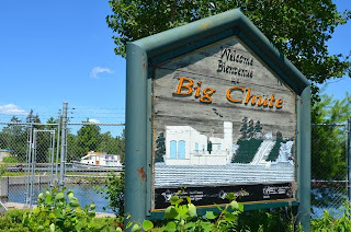
Now Carrie Rose finds herself in a waterway controlled by locks: forty-four to be exact. The Trent Severn is particularly interesting especially for three of its locks. Two of these are hydraulic and one, the Big Chute, is, well it is hard to describe. The Big Chute refers to the cataract next to the lock that spills down 58’ into the next portion of the waterway.

The Big Chute is a marine railway on steroids. It is like a wet, dry dock. The boat is driven into hanging straps, secured by lifting the boat a bit and then it moves up on rails over the hill and is gently settled back in the water 58’ higher or lower depending on which way you’re going. Carrie Rose barely knew what hit her. We arrived, they flagged us in and ten minutes later we were tied up to the lock’s overnight pier.

The next unique lock was the Kirkfield Hydraulic Lift Lock. Here too we were whisked in, being the last boats for the day and again in ten minutes we were tied up to its overnight space on the wall. The hydraulic in the title refers to the way it works. It consists of two big tubs full of water balanced on a humongous steel shaft. An underground series of valves connect them.

Boats are driven in and tied off. Then the upper tub is filled with a foot of water more than the lower and the whole contraption moves. Slow at first, then it accelerates. While leaning over the rail to photograph the process it came up fast enough that I instinctively back away. One tub, boats and all went up and the other tub with one extra foot of water went down. The operation was so smooth that it was a shock to find ourselves forty-nine feet higher. I fired up the engine; we untied from the tub and motored into a long narrow concrete lined canal.

Kirkfield Lock was the culmination of a long day going up. We traversed Gamebridge (11’), Thorah (14’), Portage (13’), Talbot (14’), Bolsover (22’) and Kirkfield (49’) locks for a grand total of 123 feet up. It was one hot sweaty day and we were wasted. Carrie Rose was sealed as tight as possible, the generator started and our much appreciated but wimpy air conditioner turned on. The sun was low on the horizon before we dared to venture out into the diminishing heat.


Wilderness Lock, No road access


Waiting to go in


Waiting for them to come out


Sir Tugley Blue makes it look easy


Kirkfield Hydraulic Lift Lock


In the tub on the way up


Under the tub


Out the front


A magnificent erector set


Monday, July 15, 2013

Today

Today we started at the top of the wilderness dam at Swift Rapids and during the next three and a half hours either saw or did the following: beautiful cottage country, forest and crystal clear water, transited two lakes and several rapids, locked through another lock, waited for two railroad bridges to open, drove through blasted cuts, on a river and on a canal, passed through several small towns, motored under a major highway, passed multiple marinas, averaged 10 km/h, eventually tied up at the Port of Orillia’s marina and had a great pizza at Zats.

Lock: A Pictorial 2


Yes! We are going in that...


Driving in...


Sir Tugley Blue right behind us...


Up we go...


58'up over the hill...


Crossing the road...


Welcome to The Big Chute!

Lock: A Pictorial 1


Port Severn lock is just around a narrow corner!


If it looks chaotic that's because it is!


Resting up top


What else could a guy need?


Drive in,


Fill it up, open the gate and drive out.