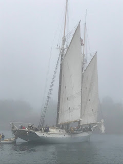
Camden’s inner harbor is a revelation. Camden itself is approached from the formidable West Penobscot Bay. The west and east bays are separated by a series of shattered islands, the largest being Islesboro. We crossed the bays from Pulpit Harbor on North Haven Island.
There are several approaches and it does not amount to much of a cruise at about nine miles but it illustrates how a few miles here or there can make a difference in the characteristics of the water we traverse.
In the past, at least according to my saved route, I went south around the Red #12 buoy to avoid passing through the islands. I have become familiar with the surroundings and though that does not mean I have let my guard down, it does mean I have more options when it comes to choosing a route.
But let me stop here and discuss a hardwired problem I have navigating in Maine. Like pelagic birds that migrate by instinct, spending most of my boating life in Chicago and on Lake Michigan, I am wired for a simplistic view of the four cardinal directions. Chicago is built on a north south, east west grid, and Lake Michigan juts straight down from north to south.
I instinctively know north from south and east from west when I am in its waters or on its shore. This is not the case in Maine. Maine’s shoreline, if I can call the jumble of islands, inlets, and bays that make up the coastline a shore, runs more east as it creeps it way north. My beloved grid does not exist in Maine and I find this disconcerting.
Enough of that: back to the bays. East Penobscot Bay is sheltered from the North Atlantic by the bulk of Vinalhaven Island and its assortment of eastern offshore islets. North Haven Island, the almost conjoined partner of Vinalhaven, contributes its most eastern Stand-in Point to deflecting the Atlantic’s swell. The Atlantic has a straight shot into West Penobscot Bay.
Pulpit Harbor is a secure anchorage: little disturbs it. Being close to Rockland, Camden, and Belfast, three cities that harbor most of the schooner fleet, it is a popular destination for them. We left for Camden in the morning after several days of high winds and expected to meet some of the remnant seas but it was mostly calm.
The course was close to straight west across both bays traversing midway between Saddle Island to the north and Mark Island to the south. The temperature had been rising on land but once out on the water it dropped substantially. The trip across the east bay and through the islands was choppy but overall sedate.
Once out of the lee of Mark Island the sea state changed. I could feel Carrie Rose’s stern rise and twist as it does in a following sea. The short choppy seas were on our port and it was joined by an easy ocean swell on our port stern quarter. The water appeared a darker blue and a chill filled the air. I looked around for a shirt as goose bumps appeared on my forearms.
Camden has an outer and an inner harbor. A lighthouse on Curtis Island and several outer and inner ledges border the entrance to the outer harbor. There is a large mooring field and a confusing mixture of unique navigational aids. To add to the confusion, this is a busy harbor. Schooners are coming and going, launches crisscross every which way, all kinds of fine recreation crafts are on the move; it is a bit of a jumble.
And then there is always the radio. I was on Channel 71 discussing with the dock master a fifteen minute delay at the fuel dock. I began a 90 degree turn into the mooring field to kill time when he said come right in, so I kept my wheel turned and resumed the previous course.
I was confused as to the correct dock and then I saw the large green diesel hoses serpentine on the deck. There was a special forces looking tourist go fast boat leaving, so I throttled back to keep control in the current as it maneuvered into the channel. When I felt Carrie Rose’s starboard side clunk into the dock, I realized this was the first time in two years that we pulled up to a pier and I smiled.


